Western Washington priority · Eastern Washington & Oregon coverage
Aggregate mining consulting for the Pacific Northwest.
Geographic Solutions helps aggregate producers, landowners, contractors, and investors permit, map, evaluate, plan, and value sand and gravel pits and rock quarries.
Core focus
Specialized support for pits, quarries, reserves, permits, and aggregate markets.
Most consultants know one piece of the project. Geographic Solutions connects permitting, GIS, drone mapping, reserves, mine planning, and market analysis into one practical strategy.
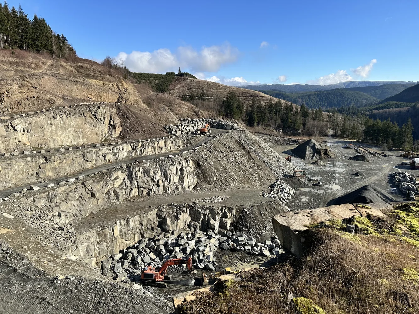
Mine Permitting & Reclamation
Permitting strategy, DNR reclamation plans, SEPA support, local land-use approvals, and compliance exhibits for pits and quarries.
Learn more →Market Studies & Due Diligence
Mine-life projections, reserve context, sales estimates, haul-cost analysis, and acquisition support for aggregate assets.
Learn more →Drone Mapping & Mine Planning
Stockpile inventory, topographic surfaces, cut/fill, reserve modeling, and mine-planning support using current field data.
Learn more →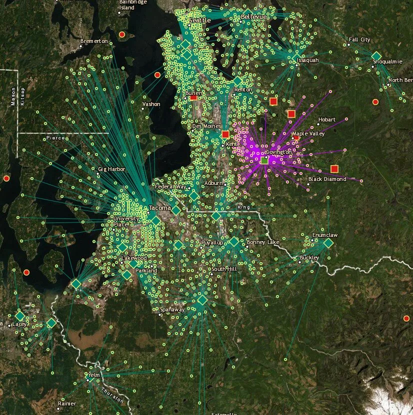
For operators, landowners & investors
Data-backed decisions for local aggregate supply.
Aggregate is a local, logistics-driven business. Site value depends on reserves, permit limits, haul cost, product quality, competing supply, depletion, and market demand. Geographic Solutions builds maps, models, studies, and permit strategies that make those factors easier to understand.
Why Geographic Solutions
Technical mapping, permitting insight, and business judgment in one place.
Project experience
Recent work includes permitting, valuation, market studies, drone mapping, and reserve expansion.
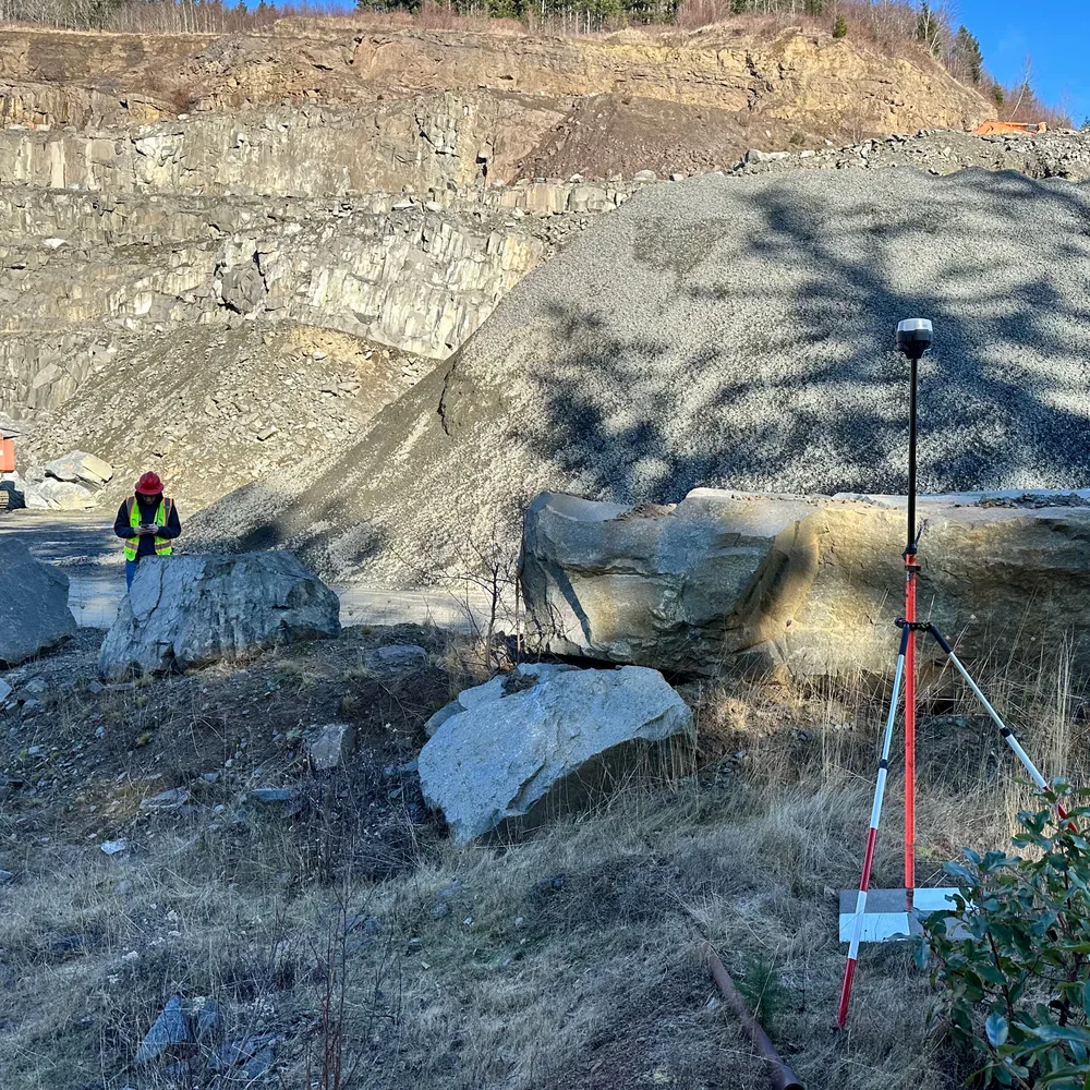
SGGP compliance for Western Washington quarry and recycling site
Provided Sand & Gravel General Permit compliance support, practical site mapping, and documentation for an active quarry and recycling operation.
Quarry lease advisory
Advised an aggregate operator on lease terms for a quarry opportunity, tying commercial terms to resource, permitting, and operational risk.
Puget Sound aggregate market analysis
Built mine-life projections, sales estimates, and interactive web-map outputs to support regional aggregate planning and business decisions.
Sand and gravel pit valuation
Supported an owner in valuing a sand and gravel property interest and negotiating the sale of shares in the property.
Technical resources
Existing blog content preserved and rebuilt as a resource library.
The new site keeps the existing indexed article URLs while improving internal links, page structure, metadata, and calls to action.
Ready to evaluate a site?