Published 2025-08-29
The construction industry is under constant pressure to deliver projects on time, on budget, and with precision. At Geographic Solutions, we provide advanced construction drone services across Washington and the Pacific Northwest that give contractors and engineers the data they need to make better decisions.
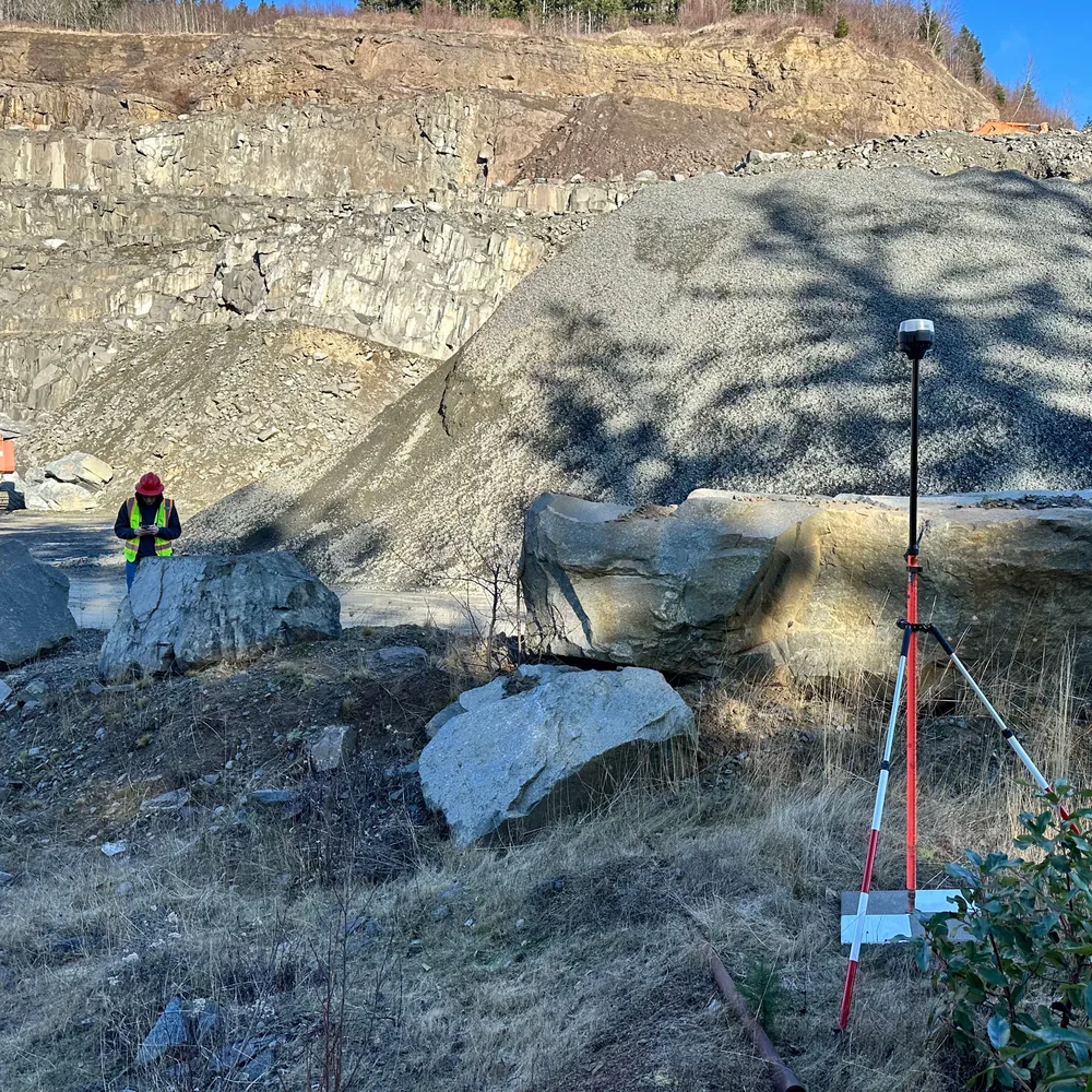
Using drones equipped with high-resolution cameras and LiDAR sensors, we capture aerial data that is processed into maps, 3D models, and volumetric reports. These deliverables allow construction teams to measure quantities, monitor progress, and verify pay items with accuracy that traditional methods can’t match.
What Are Construction Drone Services?
Construction drone services are the use of drones to survey and document construction sites. Instead of relying solely on manual surveys or rough estimates, contractors can now access high-accuracy data in a fraction of the time.
At Geographic Solutions, our drone mapping services for construction include:
- Cut/Fill Analysis: Determining exactly how much material needs to be excavated or placed.
- Cut/Fill Maps: Creating visual maps that highlight cut and fill areas in color-coded detail.
- Stockpile Measurement: Calculating accurate volumes of soil, gravel, asphalt, and other materials.
- Progress Tracking: Monitoring site changes with repeat drone flights and consistent reporting.
Benefits of Construction Drone Services
Drones provide more than just convenience — they directly improve profitability and reduce risk.
- Double-Check Engineer Estimates: Design estimates don’t always match field conditions. Drone mapping allows contractors to verify cut/fill quantities before moving dirt, ensuring estimates are realistic and avoiding costly surprises.
- Get Paid What You’re Owed: Payment disputes over bid items can cost contractors significant money. With drone data, you have proof of quantities moved or placed, ensuring you are paid fairly for the work performed.
- Reduce Survey Costs: Traditional ground surveys are expensive and time-intensive. Drones can map an entire site in hours instead of days, at a lower cost.
- Improve Safety: No more climbing stockpiles or working in hazardous areas. Drones collect data safely from above, keeping your crew out of harm’s way.
- Track Progress with Confidence: By flying a site weekly or monthly, contractors can document project milestones and provide stakeholders with visual progress updates. This creates accountability and improves communication.
Cut/Fill Analysis with Drones
Earthwork is often the most expensive part of a construction project. Even small miscalculations in cut/fill quantities can add up to thousands of dollars.
With our construction drone services, we:
- Capture aerial data over your site.
- Process it into a 3D surface model.
- Compare the model to design grades or previous surveys.
- Deliver color-coded cut/fill maps and precise volume calculations.
This ensures your team always knows how much material to move and where — preventing disputes, protecting profits, and keeping projects on track.
Progress Tracking and Documentation
Construction is fast-paced, and conditions change daily. Regular drone flights create a visual timeline of your site’s evolution.
- Provide owners with progress updates.
- Document site conditions for change orders.
- Reduce disputes by having a permanent digital record of the job.
This kind of documentation is invaluable in resolving claims or verifying work completed.
Real-World Applications in Washington
Contractors across Washington are already using construction drone services to improve efficiency and accuracy in:
- Highway and roadway construction: Ensuring cut/fill operations match design grades.
- Subdivision development: Tracking grading progress and confirming lot preparation.
- Commercial and industrial sites: Monitoring site prep, stormwater pond excavation, and pad grading.
- Quarries and borrow pits: Measuring material availability and production rates.
At Geographic Solutions, we support construction firms across Seattle, Tacoma, Portland, and throughout the Pacific Northwest, helping them protect their bottom line with reliable drone data.
Learn More About Mapping Methods
At Geographic Solutions, we offer both LiDAR mapping and photogrammetry mapping for construction projects. Each has its own advantages depending on the site.
Want to learn more? Check out our blog: LiDAR vs. Photogrammetry: Choosing the Right Drone Mapping Tool.
Why Work with Geographic Solutions?
When you hire Geographic Solutions for construction drone services, you get:
- Accuracy within a few centimeters — essential for engineering-grade decisions.
- Actionable deliverables — cut/fill maps, stockpile reports, and volumetric data you can use immediately.
- Local expertise — we know Washington’s construction environment and regulatory requirements.
- Industry focus — we specialize in aggregates, construction, and permitting, so we understand the data that matters most to you.
If you’re ready to improve accuracy, reduce costs, and protect your bottom line, Geographic Solutions can help.
We provide professional construction drone services in Washington, including cut/fill analysis, stockpile measurement, and site progress tracking.
Contact us today to schedule a consultation and see how drone mapping can transform your construction project.
How Geographic Solutions can help
Geographic Solutions supports aggregate operators, landowners, contractors, and investors with permitting, mapping, reserve modeling, market studies, valuation, and due diligence for pits and quarries in Washington and Oregon.